Corralejo Beaches: Grandes Playas, Dunes and Town Coast
Plan a beach day in Corralejo: the Grandes Playas along the dunes, where families swim, the wind that shapes them and which nearby beaches to combine.
On this page
Corralejo pairs a working resort town with one of the Canary Islands' strangest coastal landscapes: a belt of white sand dunes that spills straight onto nine kilometres of beach. That combination gives you an unusually wide choice for one base, from broad family sands within walking distance of the town to wilder southern stretches where the trade wind dictates the day. This guide groups the coast by character so you can pick the stretch that matches your group rather than working through a list.
The beaches are not a single entity but a line of named coves and bays strung along the Dunas de Corralejo Natural Park, each with its own depth, shelter and crowd level. Wind is the constant here, shaping both the dunes and the way people use the sand, so plan around it rather than against it. The details below cover access, the water, facilities, timing and the best combinations for a full day out.
What makes Corralejo's beaches worth the trip
The headline is the setting: the dunes of the natural park run parallel to the north-eastern coast for around ten kilometres, reaching heights of up to 50 metres, and the beaches sit directly beneath them. Few European resort coasts put a protected dune field and a long sandy shoreline in the same view, and the contrast between white sand, ochre volcanic ground and blue Atlantic water is what people come for. It suits travellers who want a beach day with a walk attached, rather than a lido-only experience.
The trade winds that blow from the African coast define the experience. They keep temperatures stable through the year, build the dunes themselves, and on breezy days send people hunting for shelter behind hand-built stone windbreaks known as corralitos. The same wind that makes a family afternoon uncomfortable in an exposed spot is what fills the windsurfing and kitesurfing schools along this coast. Pick your stretch with that in mind: the north has the widest, most forgiving sand, while the southern beaches are shorter and more exposed.
Where Corralejo's beaches sit
The town of Corralejo occupies the northern tip of the municipality of La Oliva, and the dunes begin immediately beside it, running south-west along the coast. The FV-1 connects the island capital, Puerto del Rosario, with the resort, and the FV-1A slices directly through the park, which makes the dune coast easy to reach by road but means you cannot simply drive onto the sand. The beaches themselves are explored on foot via designated trails.
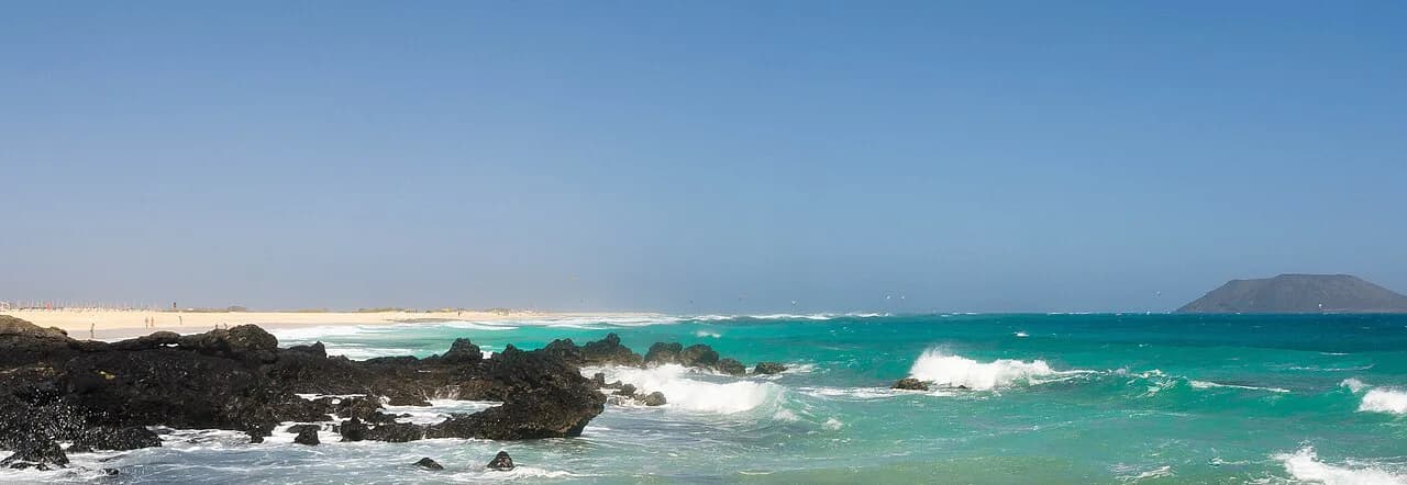
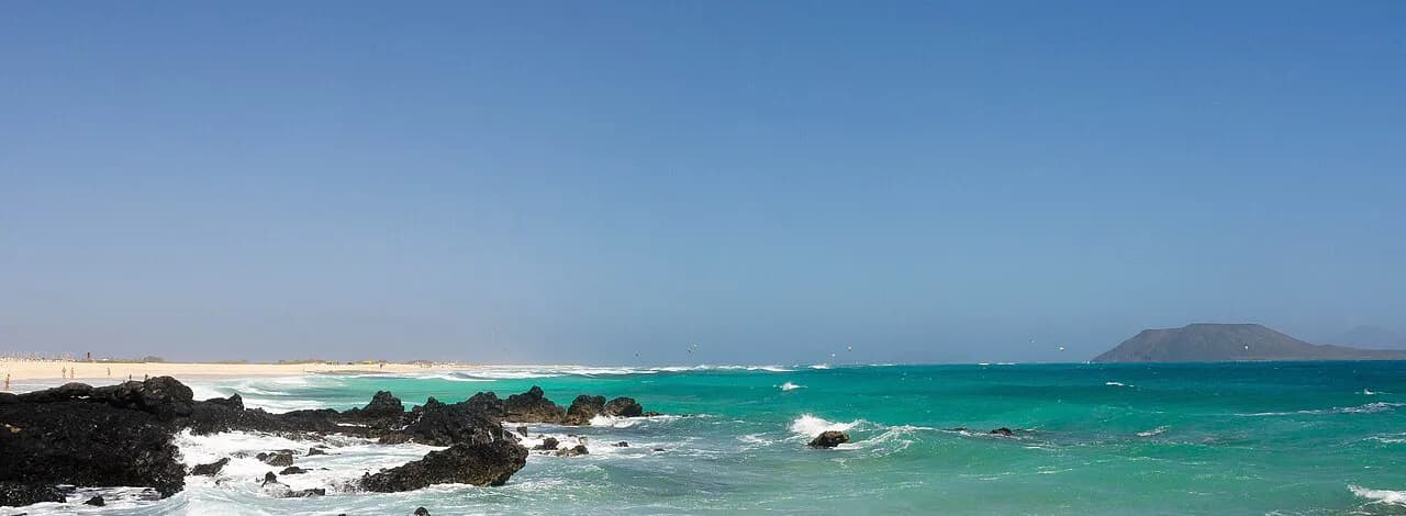
Think of the coast in three parts: the town end closest to Corralejo, the long dune-backed run of the Grandes Playas, and the shorter southern bays towards Montaña Roja, the 312-metre volcanic cone that anchors the park's southern section. Montaña Roja also offers a hiking route to its summit with views over northern Fuerteventura, Lobos Island and Lanzarote, which makes it a natural bookend to a beach day. Beyond the coast, the uninhabited Lobos island lies about two kilometres offshore and is included in the same protected landscape.
The Grandes Playas: nine kilometres of sand backed by the dunes
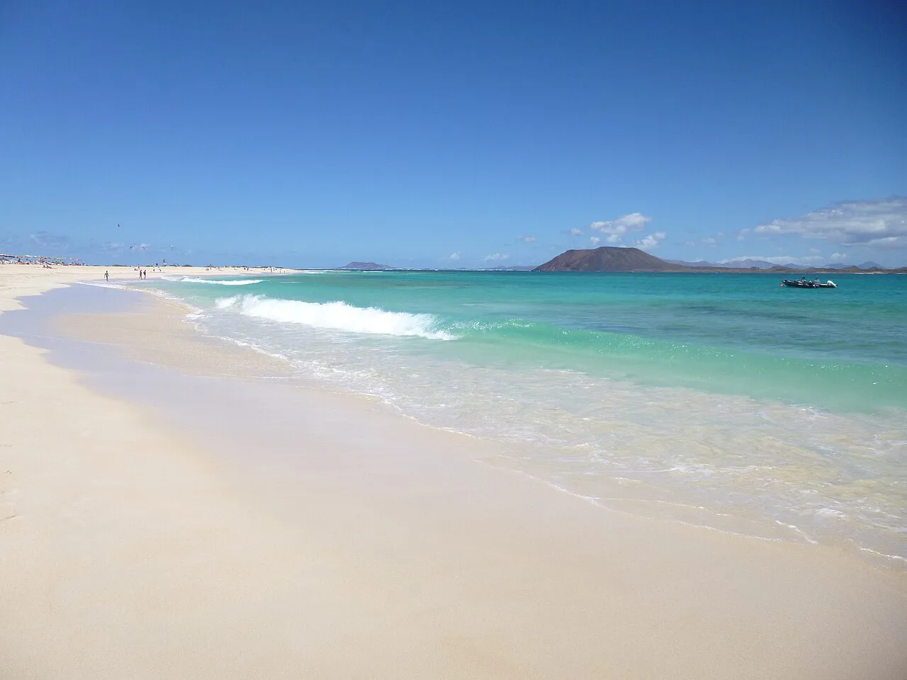
The Grandes Playas de Corralejo border the dunes for nine kilometres, forming the backbone of any beach holiday here. The sand is white and the water turquoise, and the beaches are varied enough that you can move along the coast through a week without repeating yourself. Because they sit within a protected natural park, they feel less built-up than the resort strip in town, and the walking between them is part of the appeal.
The typical rhythm here is a morning walk through the dunes followed by an afternoon swim, which uses the light and the wind at their best. Bear in mind that the beaches are frequently lashed by the trade winds, so an exposed spot can be bracing while a bay a few hundred metres away feels calm. Arrive early if you want a wide choice of sand and a shorter walk from the access points; the most convenient stretches fill first.
El Pozo, El Viejo and Bajo Negro: the northern family beaches
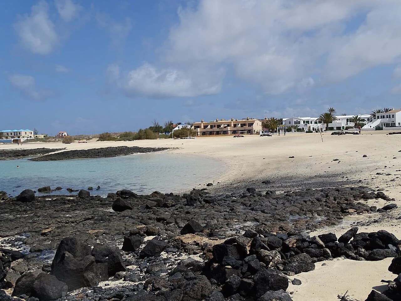
The further north you go along the dune coast, the wider and more family-oriented the beaches become. El Pozo, El Viejo and Bajo Negro are the three names to know, all broad sands backed by dunes and close to the town end of the park. They are the easiest option if you are staying in Corralejo and want a beach day without a long drive or a serious walk.
Bajo Negro stands out as the pick for families with small children: the wind blows less fiercely than on neighbouring beaches and the shore stays shallow for several metres. That combination of lighter wind and a gently shelving entry is rare on this coast and makes it the safest bet for toddlers and nervous swimmers. El Pozo and El Viejo are similarly wide and accessible, so you can walk between them and choose based on how the wind is behaving on the day.
El Burro and El Moro: the shorter, wilder southern beaches
Heading south through the park, the beaches become shorter and wilder, with less sand between the water and the volcanic ground. El Burro and El Moro are the two fine examples, and they suit travellers who prefer a rougher, more exposed shoreline to the broad family sands in the north. The swimming here depends more on conditions, so treat them as fair-weather options rather than all-day family bases.
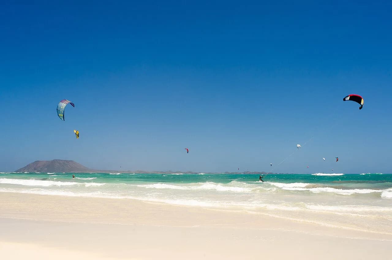
El Burro has hosted the International Kite Festival since 1987, which tells you something about the wind on this stretch. If you are visiting in a breezy spell, the southern beaches are where the wind-sports crowd heads, and the spectacle of kites overhead is part of the day. For a quiet swim, choose a calmer morning and keep an eye on which way the wind is blowing before committing.
The wind: corralitos, kitesurfing and windsurfing
The trade winds that arrive from neighbouring Africa are the single biggest factor in planning a beach day here. They shape the dunes, dictate where people sit, and have turned this stretch of coast into a hotspot for surfing, windsurfing and kitesurfing, with a large number of schools operating in the area. If you want to learn a board sport, this is one of the most reliable coasts in Europe for it.
For non-sailors, the practical response is the corralito: a circular windbreak built by hand from stones, which you will see dotted across the sand on breezy days. Building one is part of the local beach routine and gives you a sheltered pocket without carrying equipment. Bring a light windproof layer and a towel that doubles as a screen, and choose a bay with a dune shoulder behind you for extra protection.
The sand and the water
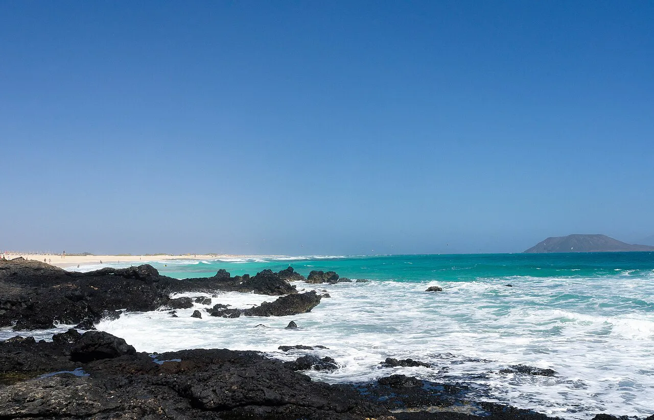
The beaches are white sand over the volcanic malpaís that formed more than 50,000 years ago, which gives the coast its pale colour and warm tone. The dunes began in the north beside Corralejo and reach up to 50 metres above sea level, so the sand you sit on is part of a much larger system rather than a thin resort strip. How quickly the water deepens varies by bay, which is why the northern family beaches are worth seeking out.
On the northern beaches the shore stays shallow for several metres, particularly at Bajo Negro, while the shorter southern bays drop away more quickly. For swimmers who like open water, the southern stretches offer more of a challenge; for children, stay north. The sea is turquoise and clear on calm days, and the park's beaches are described as varied and unspoilt, which is a fair summary of what you get.
Getting there: FV-1, the dune trails and reaching the beaches on foot
The FV-1 is the main road connecting Puerto del Rosario with Corralejo, and the FV-1A runs through the natural park itself, so the dune coast is easy to reach by car or taxi. The catch is that you cannot drive onto the dunes or the beaches: the park is explored on foot using designated trails. Plan for a walk of some minutes from where you leave the road to where you settle on the sand.
From Corralejo town, the northern beaches are the closest and can be reached on foot or with a short taxi ride, which makes them the practical choice for a low-effort day. The southern bays towards Montaña Roja need wheels unless you are a committed walker. Take water and sun protection even for a short walk through the dunes: there is little shade and the sand reflects the heat.
Facilities and beach set-up along the dune coast
Facilities are concentrated in and around Corralejo town and at the town-end beaches, while the dune coast is deliberately left unbuilt within the natural park. Travel operators do not publish a single map of lidos, sunbed rentals and beach bars for the whole dune run, so if a fixed sunbed and a nearby bar matter to you, base yourself at the northern family beaches and walk south rather than starting in the wilder middle.
Because the park is a protected area, the general expectation is that you carry in and out what you need for the day. Bring water, food, shade and a windbreak if you are heading deep into the dunes; the walk back is longer than it looks. For anyone who prefers a resort-style set-up with everything within a few steps, the town beaches are the better base and the dune coast makes a good half-day excursion.
Best time to go: trade winds, temperatures and the busiest months
The beaches enjoy stable temperatures all year round, which makes Corralejo a genuine winter-sun destination as well as a summer one. The busiest months cluster around the European school holidays, when the northern family beaches fill first and the town-end sands get crowded. Outside those weeks, you can usually find space even on the accessible stretches.
Wind is the variable that matters more than temperature: a breezy spring or autumn day can feel cooler than the thermometer suggests, while a still summer day is hot with little shade. Two events are worth knowing about if you are planning around them. The dunes host the Fuerteventura Dunes International Half Marathon every November, with 95% of the 21-kilometre route inside the natural park, and the International Kite Festival has been held at El Burro since 1987; the organisers publish exact dates each year.
Combining beaches: El Cotillo, Lobos Island and the north coast
The natural pairing with Corralejo is Lobos island, about two kilometres offshore and included with the dunes in the same 1982 natural park declaration. Visits are managed: you need a permit from the Island Council of Fuerteventura, which is issued for visits throughout the year. The island is uninhabited under strict protection rules, so plan a day around the crossing rather than treating it as a quick hop.
On the island, the two swimming spots worth naming are La Concha and Caleta de Rasca, the latter beside the only restaurant on the island. A climb to the top of La Caldera, the volcanic cone in the north-west, gives clear views back to Fuerteventura and across to Lanzarote. For a longer beach-focused trip on Fuerteventura, the south of the island offers the big exposed sands of Playa de Sotavento de Jandía.
Lobos Island: La Concha and Caleta de Rasca
Lobos takes its name from the sea lions once found on its rocks, and it was inhabited on and off by pirates before a permanent population grew around the Punta Martiño lighthouse from 1860. Today it is uninhabited and protected, with six square kilometres of land and 14 kilometres of coastline to explore on foot. That makes it a walking day with swimming stops rather than a sunbathing resort.
La Concha is the main swimming beach, and Caleta de Rasca is the second option beside the island's only restaurant. Both make good lunch stops between walks, and the climb to La Caldera fits neatly into the middle of the day. For the broader picture of Fuerteventura's beaches before you commit, the island-wide guide is a useful planning companion.
Practical kit: shade, windbreaks and wind protection
Pack for wind and sun at the same time. A windbreak, a light long-sleeved layer, a hat with a chin strap, high-factor sun cream and plenty of water cover most days on this coast. Reef-safe sunscreen and a dry bag are sensible additions if you plan to swim between bays or take the crossing to Lobos.
For the dune walks, closed shoes beat flip-flops, and a refillable bottle is worth the weight because there is little shade and no guarantee of a shop between the town and the southern bays. A beach umbrella that can be pegged down copes better with the trade winds than a lightweight one, and a spare towel works as a wind screen when you build a corralito.
Who each beach suits
Families with small children should head for Bajo Negro, where the wind is lighter and the shore stays shallow for several metres, with El Pozo and El Viejo as nearby alternatives. Swimmers who want more space and a bit of challenge will prefer the shorter southern beaches around El Burro and El Moro. Wind-sports enthusiasts are best served along the whole dune coast, where the schools cluster and the trade winds do the work.
Quiet-seekers should walk south from the town-end beaches into the natural park, where the sand is unbuilt and the crowds thin out quickly. If you want a resort-style day with everything close at hand, stay near Corralejo town and use the dunes as a morning excursion. For comparison with other Spanish beach bases, the beaches around Alicante and the sands of Playa del Postiguet offer a very different, more urban experience, so it is worth weighing Alicante beaches against Corralejo if you are deciding between the two.
Dogs in the Corralejo dunes: walking trails, wildlife and beaches
Because the FV-1A slices through the Corralejo sand dunes, the dunes themselves can only be explored on foot using designated trails — which is exactly why a dog walk here is a trail walk rather than a free run over the sand. The park is a Special Protection Area for Birds (SPA), and the birds are its biggest asset: the great bustard, the houbara bustard, the cream-coloured courser, the stone-curlew and the common kestrel all inhabit the area. Mammals are present too, and it is not unusual to see rabbits, squirrels and Fuerteventura goats. On the ground, much of the flora is xerophile, adaptable to arid soils, and includes endemic local species such as Androcymbium psammophilum and Tetraena fontanesii. Keeping a dog on the designated trail protects all of this — and keeps the walk legal, since the dunes are not open to wandering off-path.
The shape of the park rewards a bit of planning with a dog. The dunes begin in the north, beside the coastal town of Corralejo, and can reach heights of up to 50 metres above sea level; the southern section is where the exposed soil appears, formed by solidified basalt flows that were once magma, and it is also home to Montaña Roja, a volcanic cone with a height of 312 metres whose summit offers views of northern Fuerteventura, Lobos Island and the neighbouring island of Lanzarote via an excellent hiking route. North or south, the same rule applies: foot access on designated trails. The Grandes Playas de Corralejo border the dunes for nine kilometres, so a dune walk and a beach stop sit naturally together — but note that these beaches are described as nudist friendly and are frequently lashed by the trade winds that come from neighbouring Africa.
Wind shapes the day more than anything else. On the beaches, the same wind that draws surfing, windsurfing and kitesurfing also produces the so-called corralitos: circular-shaped windbreaks constructed by hand out of stone. For a dog, those stone rings are shelter, and the stable temperatures the beaches enjoy all year round mean the main concerns are sand in the eyes and the strength of the gusts rather than heat alone. Every November the dunes host the Fuerteventura Dunes International Half Marathon, a 21-kilometre race of which 95% is set within the confines of the natural park, so expect the trails to be busy with runners around that date.
Timing and terrain matter as much as rules. The park was declared a natural park in 1982 together with the neighbouring Lobos Island, and the dunes were recognised as a single entity under the official name of Dunas de Corralejo Natural Park in 1994; it spans 2,600 hectares, a width of 2.5 kilometres and a length of 10 kilometres, runs parallel to the north-eastern coast in the municipality of La Oliva, and is considered the largest in the Canary Islands. Beneath the white sand lies the typical Canarian malpaís, a volcanic landform formed over 50,000 years ago when the volcanoes that dot the area erupted simultaneously — uneven ground that is hard on paws, so the designated trails are kinder than cutting across the sand.
Crossing the dunes on foot with a dog: trails, distances and conditions
If you are staying in Corralejo with a dog, the shape of the natural park matters more than any single beach. The Dunas de Corralejo span 2,600 hectares, a width of 2.5 kilometres and a length of 10 kilometres, running parallel to the north-eastern coast in the municipality of La Oliva. The FV-1A literally slices through the dunes, and the dunes themselves can only be explored by foot using designated trails. For a dog walk that means committing to a marked route rather than cutting loose across the sand, and it also means planning the crossing around the road rather than simply following the coast. The park was declared in 1982 together with the neighbouring Lobos Island and recognised as a single entity under the official name Dunas de Corralejo Natural Park in 1994.
Water is the detail most often underestimated. The dunes stretch for almost 2 miles inland, and a long walk through them is likely to leave you totally on your own; if you go for a long walk, take water with you, as it can be hard going and dehydrating. The inland sand reaches heights of up to 50 metres above sea level in places, which adds up over a couple of hours under the sun. The park is also a Special Protection Area for Birds, home to great bustards, houbara bustards, cream-coloured coursers, stone-curlews and common kestrels, as well as rabbits, squirrels and Fuerteventura goats, so a dog on a designated trail is both a legal requirement in spirit and the practical way to avoid disturbing ground-nesting wildlife.
Timing your outing around the park's calendar helps too. Every November the dunes host the Fuerteventura Dunes International Half Marathon, a 21-kilometre race of which 95% is set within the confines of the natural park, and the same month brings the International Kite Festival, organised across the shores of Corralejo and La Oliva and running for about a week. Both fill the sand and the access points, so a quieter dog walk is easier outside those dates. The trade winds that come from neighbouring Africa lash the beaches frequently, which is worth knowing before you set out with a dog that dislikes blowing sand.
Plan Your Corralejo Beach Day
Corralejo rewards a bit of planning: choose the northern family beaches for shallow water and easier access, the southern bays for space and wind, and the dunes for a morning walk before the afternoon swim. Build a corralito if the wind picks up, carry water and shade, and keep a day spare for Lobos island.
If you are staying longer, the wider Fuerteventura beaches guide puts Corralejo in context with the island's southern sands, and the Corralejo tourist office can advise on current beach conditions and events during your stay.
Explore more Corralejo beaches
Frequently Asked Questions
Where are the best beaches in Corralejo?
The Grandes Playas de Corralejo, which run for nine kilometres along the Dunas de Corralejo Natural Park, are the main draw. Within that run, El Pozo, El Viejo and Bajo Negro in the north are the widest and most family-friendly, while El Burro and El Moro in the south are shorter and wilder.
Which Corralejo beach is best for families with small children?
Bajo Negro is the strongest choice: the wind blows less fiercely than on neighbouring beaches and the shore stays shallow for several metres. El Pozo and El Viejo nearby are broader alternatives if Bajo Negro is busy.
Can you swim at the Corralejo dunes beaches?
Yes. The dunes are backed by long beaches with turquoise water, and the northern ones have the gentlest entry. The southern beaches are shorter and more exposed, so conditions vary more; pick your spot based on the wind on the day.
Why is it so windy on the Corralejo beaches?
The trade winds arrive from neighbouring Africa, shaping the dunes and making this coast a hotspot for surfing, windsurfing and kitesurfing. Beachgoers often build circular stone windbreaks called corralitos for shelter.
How do you get to the Grandes Playas from Corralejo town?
The FV-1A runs through the natural park, so the coast is easy to reach by road, but you cannot drive onto the dunes or the beaches. Access is on foot via designated trails, with the northern beaches closest to town.
Is Lobos Island worth combining with a Corralejo beach day?
It makes a strong separate day: the uninhabited island lies about two kilometres offshore and offers swimming at La Concha and Caleta de Rasca plus a climb up La Caldera. Visits require a permit from the Island Council of Fuerteventura, so plan ahead rather than turning up on spec.
When is the best time of year to visit Corralejo's beaches?
Temperatures are stable all year, so winter sun works well. The busiest months follow European school holidays, and wind can make spring and autumn feel cooler than the thermometer suggests.
Sources
Beach notes for your next trip
Optional updates when we add or revise beach guides.
You might also like

Continue reading
More guides you'll find useful