Playa de los Muertos, Almería: Access & Parking Guide
Plan a day at Playa de los Muertos in Cabo de Gata: the cliff paths, summer parking, the sharp shoreline drop and the coves at either end.
On this page
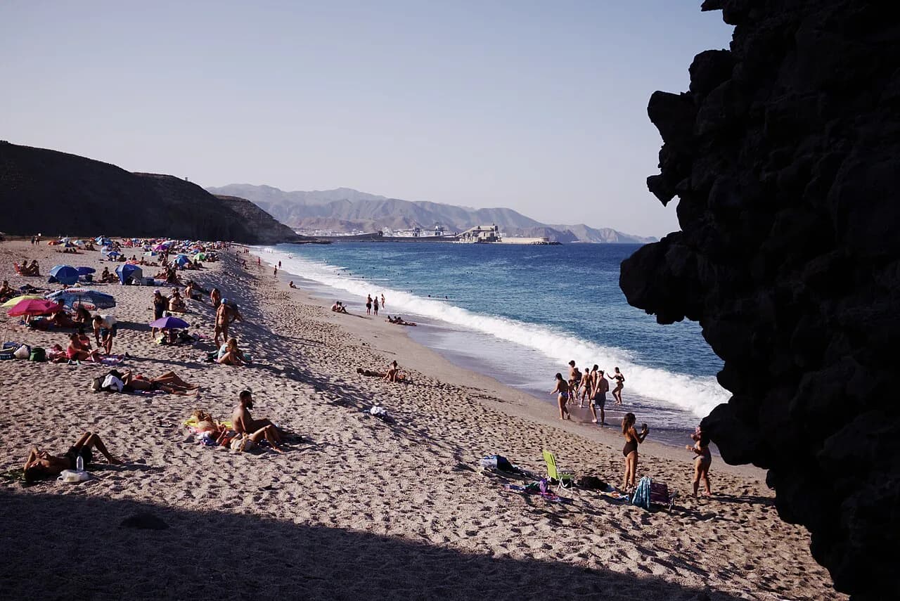
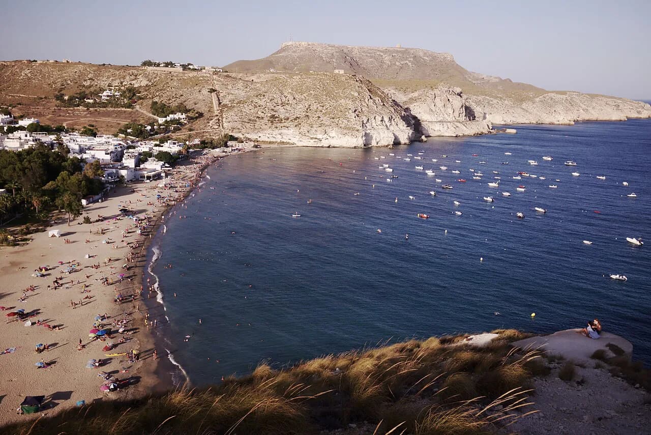
Playa de los Muertos earns its reputation on sight: a straight, kilometre-long sweep of fine white gravel and clear blue water pressed against a cliff inside the Cabo de Gata-Níjar Natural Park. It rewards travellers who accept a walk down and back up, and it suits strong swimmers, snorkellers and anyone who prefers a wild beach to a resort strip.
There are no facilities on the sand, so the day works best with a brolly, water and food carried in. Plan around the descent you can manage and the wind forecast rather than around a bar or a sunbed, and the beach gives you a full morning or afternoon.
Where the beach sits between Carboneras and Agua Amarga
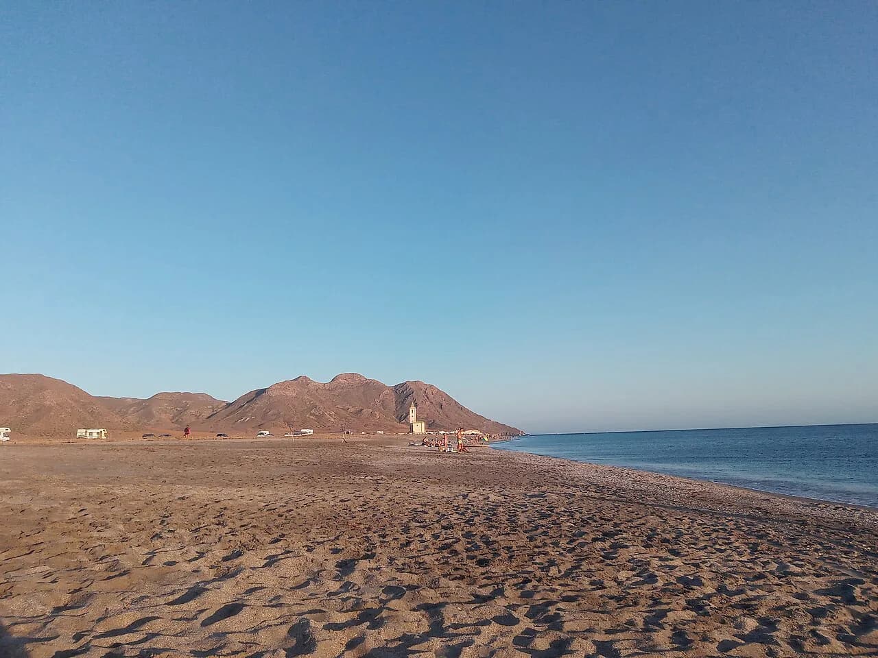
The beach lies between the coastal villages of Carboneras and Agua Amarga, both roughly equidistant from it and each about 15 minutes away by car. From Almería city it is a 78 km drive of around 55 minutes, which makes an early start worthwhile if you are coming from the city rather than staying on the coast.
The beach is unfenced, unbuilt and sits at the foot of a cliff, so everything you need arrives in your bag. It pairs naturally with a night in Carboneras or Agua Amarga, where you can eat and buy supplies before and after the beach.
Getting there by car and the summer car park
Drivers use the pay-and-display car park off the AL-5106 above the beach, and parking charges apply in the summer only. No rate is advertised by the Cabo de Gata-Níjar Natural Park authorities, so budget for a seasonal charge and pay on arrival.
From the parking area you pick up one of the marked paths down; there is no road onto the sand. Arriving early secures a space and gives you the cooler hours for the climb back.
The three walking routes down the cliff
Three paths drop to the sand, and the trade-off between them is length against steepness. The longest, at 700 metres, starts from the Tourist Information Point and is quite steep; the second begins at the edge of the car park, is shorter but much steeper; the third leaves from the Mirador Playa de los Muertos and has stone steps, making it the most accessible of the three.
A Cabo de Gata beach guide describes the two main descents as the 700-metre path from the information point and a path from the end of the parking area that is about 100 metres shorter but considerably steeper.
Access on foot is demanding, and the paths are not suitable for children, older visitors or people with mobility problems. If anyone in your group struggles with rough ground, the stepped mirador route is the sensible choice and sturdy shoes help on all three.
Arriving by boat from Carboneras
Boat trips run from Carboneras to the beach, which avoids the cliff paths altogether and gives a different view of the cliffs. Times and prices are held by the town's tourist information office rather than published online, so ask there when you arrive in Carboneras.
For anyone staying in Carboneras this is the least strenuous way to see the beach, though it ties your day to a boat schedule. Walkers who take the cliff path down can still enjoy the water without booking anything.
The sand and the water
The beach is a straight kilometre of fine white gravel, with pebbles that thin out as you approach the water. The shoreline slopes enough that the sea deepens quickly, so children need an adult alongside them and weaker swimmers should stay close to the edge.
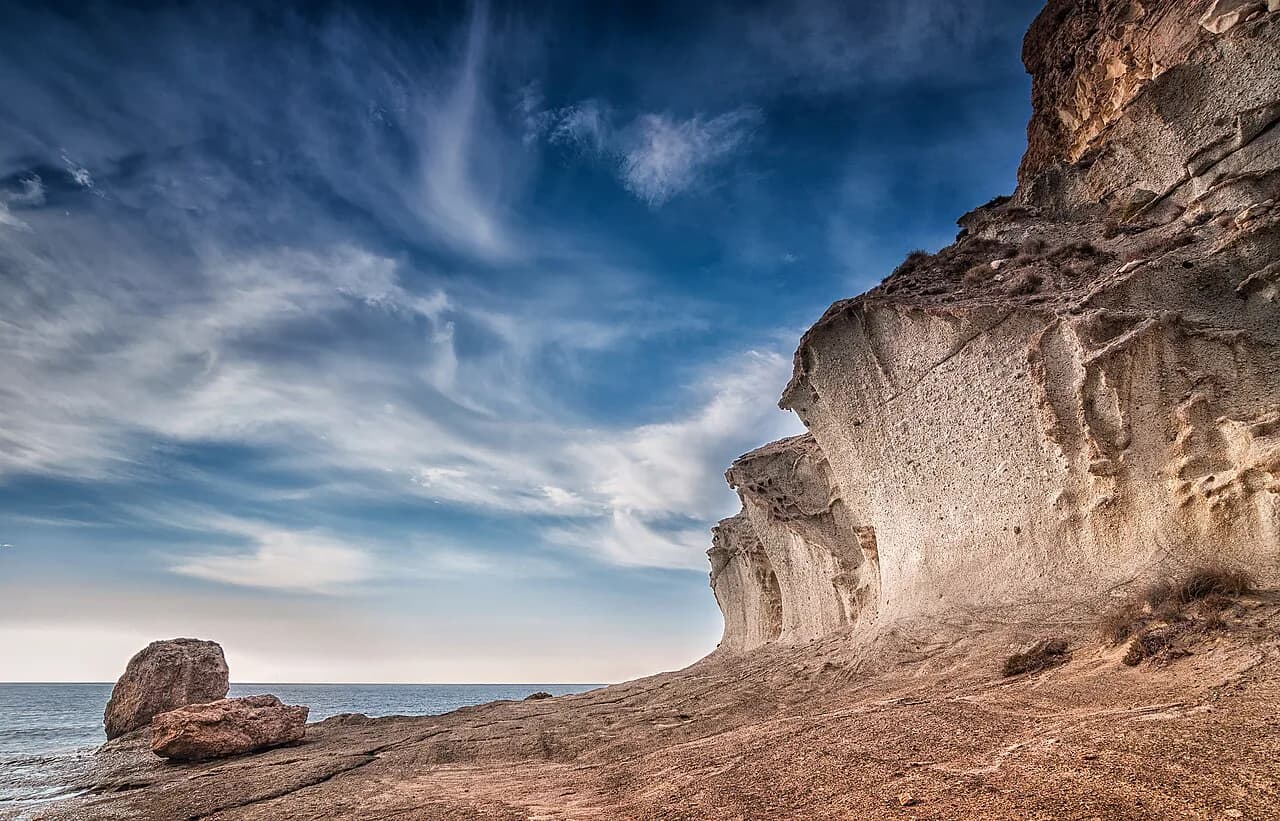
The water is clear and blue and good for snorkelling, and on normal days there is little wave action. Two large rocks sit in the sand on the right-hand side as you face the sea, marking the little cove of Cala del Peñón Cortado, which is more sheltered from the wind than the main beach.
Wind, waves and when swimming gets difficult
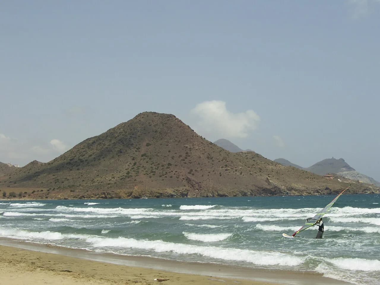
Wind direction decides the day here. Under normal conditions there is little to trouble a swimmer, but on windy days swimming becomes dangerous, and a strong easterly wind drives waves hard onto the shore so that getting out of the water is difficult.
When an easterly is blowing, treat the beach as a walking and picnicking day and head for the sheltered side at Peñón Cortado, or switch to one of the Almeria beaches that face away from the swell; the same wind-planning logic shapes a day on the beaches in Murcia further up the coast. Check the forecast before committing to the drive and the climb.
Facilities inside the natural park
Because the beach lies within the Cabo de Gata-Níjar Natural Park, it has high conservation status and no public facilities on the sand. Bring a beach umbrella for shade, sun cream, and enough food and drink for the hours you plan to stay, since there is nothing to buy at the bottom of the cliff.
Plan the bag around the climb back up: light weight matters more than comfort. A refillable bottle, a wide-brimmed hat and reef-safe sun cream cover the essentials, and a dry bag keeps valuables safe if you swim.
The naturist stretch at the left-hand end
Facing the sea, the left-hand end of the beach is used as a naturist area, a long-established part of the beach layout. It is a designated stretch of a public beach, so ordinary beach etiquette applies: keep your distance with cameras and let people get on with their day.
Families and anyone who prefers textiles tend to settle towards the middle and right-hand side, near the descent paths and the rocks at Peñón Cortado. Walking the full length of the beach makes the change obvious before you put your towel down.
Crowds and the best months to come
Summer brings crowds, with the beach described as a little crowded in the height of the season. The sea is at its warmest from July into September, and those are also the busiest weeks and the period when the car park charges apply.
Late spring and early autumn give comfortable walking temperatures for the descent and a quieter beach, though the water is cooler. Whatever the month, an early arrival gives you the pick of the gravel and a calmer climb out.
Cala del Peñón Cortado and Cala de las Salinicas
Two smaller coves flank the main beach. On the right, between the two embedded rocks and the point of Los Muertos, Cala del Peñón Cortado runs about 90 metres and offers more shelter from the wind; on the left, Cala de las Salinicas stretches roughly 200 metres with the same gravel and clear water.
Salinicas can be reached from the water or on foot from a track left of the car park towards the gazebo, then a descent of about 200 metres with a fairly steep, difficult stretch. If you want the quieter cove without a scramble, arrive by boat or settle for Peñón Cortado beside the main beach.
Mesa Roldán lighthouse and Mojácar
The Mesa Roldán lighthouse stands about 2 km south of the beach towards Agua Amarga, on top of a volcanic plateau, and houses a museum devoted to lighthouses and the lighthouse keeper's profession. The views back over Playa de los Muertos make it a worthwhile stop at the end of the day.
Mojácar is about 50 minutes down the AL-5106, an easy add-on for a late lunch or an evening walk. If you are building a longer trip, the Mojacar beaches further along the coast make a contrasting base to the wild Cabo de Gata shoreline.
Nearby beaches to combine
Carboneras itself has urban beaches with showers, lifeguard stations, bins, toilets and bars close to the sea, which makes a practical contrast to the wild beach. They suit a family day when you want facilities within reach and a shorter walk to the water.
North of Carboneras, Cala Galera is reached by a track about a kilometre beyond the last houses and a 200-metre walk down, with a stony bay at first and finer dark sand further round. Algarrobico lies along the N-341 towards Mojácar, down a track just past the river bridge, and gives you a long sandy alternative.
For a change of scene, El Playazo at Rodalquilar is a broad, open beach in the same natural park, and Cala de Enmedio near Agua Amarga adds a smaller cove to the itinerary. Both work well as a second day based in Carboneras or Agua Amarga.
If you want a city beach at the end of the trip, Playa del Zapillo in Almería gives you sand, promenade and easy transport before you fly home. It is a different kind of day from the cliff paths, and useful when the wind rules out the exposed Cabo de Gata beaches.
Practical kit for a beach with no facilities
Pack as if the car park were the last stop: water for the climb as well as the beach, food, a brolly or shade, and footwear with grip for the descent. A first-aid kit and a charged phone matter on a beach where help is a walk and a drive away.
Take your litter back up with you, since bins belong to the villages rather than the beach. Travelling light makes the return climb far more pleasant at the hottest part of the day.
Plan Your Visit
Playa de los Muertos rewards a bit of planning: choose your descent path to suit the group, arrive early for the summer car park, and treat wind direction as the deciding factor for swimming. Take everything you need down with you and leave the cove as wild as you found it.
Base yourself in Carboneras or Agua Amarga for the shortest transfer, or in Almería for a longer day out with the city beaches as a fallback. Ask at the Carboneras tourist information office about the boat, and the day plans itself.
Frequently Asked Questions
Why is Playa de los Muertos called the beach of the dead?
The name comes from the beach's position where natural sea currents converge; in the past the bodies of shipwrecked sailors were washed ashore here. The bay is now patrolled by coast guards, and the ominous name sits oddly with the white gravel and clear blue water.
How do you get down to Playa de los Muertos?
On foot. Three paths leave from above the beach: a 700-metre route from the Tourist Information Point, a shorter but much steeper path from the edge of the car park, and a stepped path from the Mirador Playa de los Muertos that is the most accessible. Boat trips from Carboneras are the alternative, with times and prices available from the town's tourist information office.
Is Playa de los Muertos good for swimming?
In normal conditions the water is clear and calm enough for a good swim, and it suits snorkellers. The shoreline drops away sharply, so children need adult supervision, and a strong easterly wind makes swimming dangerous and getting out of the water hard.
Are there facilities or sunbeds on Playa de los Muertos?
No. The beach sits within the Cabo de Gata-Níjar Natural Park and has no public facilities, so bring your own shade, food, water and sun cream. Carboneras has urban beaches with showers, toilets, bars and lifeguard stations if you want those instead.
Is there a charge to park at Playa de los Muertos?
There is a pay-and-display car park off the AL-5106 above the beach, and charges apply in the summer only. Check the machine on arrival and carry change or a card, since no rate is advertised in advance.
Is Playa de los Muertos busy in summer?
It draws a crowd in high summer, when the water is warmest and the car park charges are in force. Coming early in the day, or visiting in late spring or early autumn, gives you a quieter beach and cooler walking.
Which nearby beaches can you combine with Playa de los Muertos?
Carboneras has town beaches with full amenities, while Cala Galera and Algarrobico lie just north along the coast. Inland, the Mesa Roldán lighthouse and the village of Mojácar make easy add-ons to a beach day.
Sources
Beach notes for your next trip
Optional updates when we add or revise beach guides.
You might also like
Continue reading
More guides you'll find useful