Playa de Mataleñas, Santander: A Beach Guide for Travellers
Plan a beach day at Playa de Mataleñas in Santander: the cliff steps down to the cove, the Mataleñas park above it, and how it compares with Sardinero.
On this page
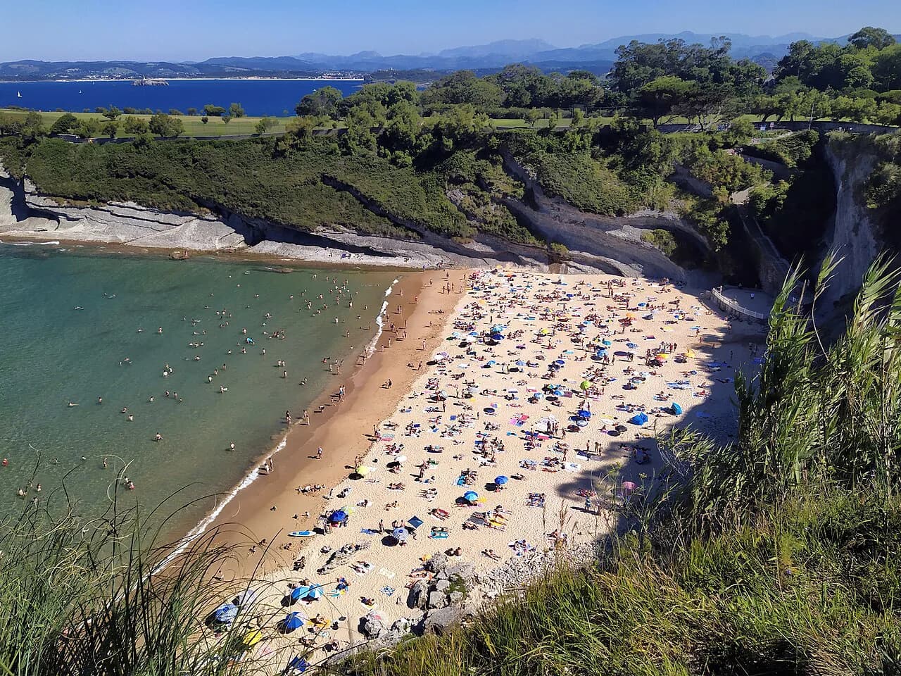
Playa de Mataleñas is the pocket-sized cove that Santander residents treat as their reward for effort: a sheltered strip of sand wedged between cliffs and open water at the northern edge of the city, reached only on foot. It suits walkers who do not mind a steep descent and climb, couples after a quieter swim than the Sardinero beaches offer, and anyone building a coastal walk between the city's headlands. Families with very young children are better placed on the sand at El Sardinero, where the promenade, shops and level access sit right behind the beach.
Where the beach sits
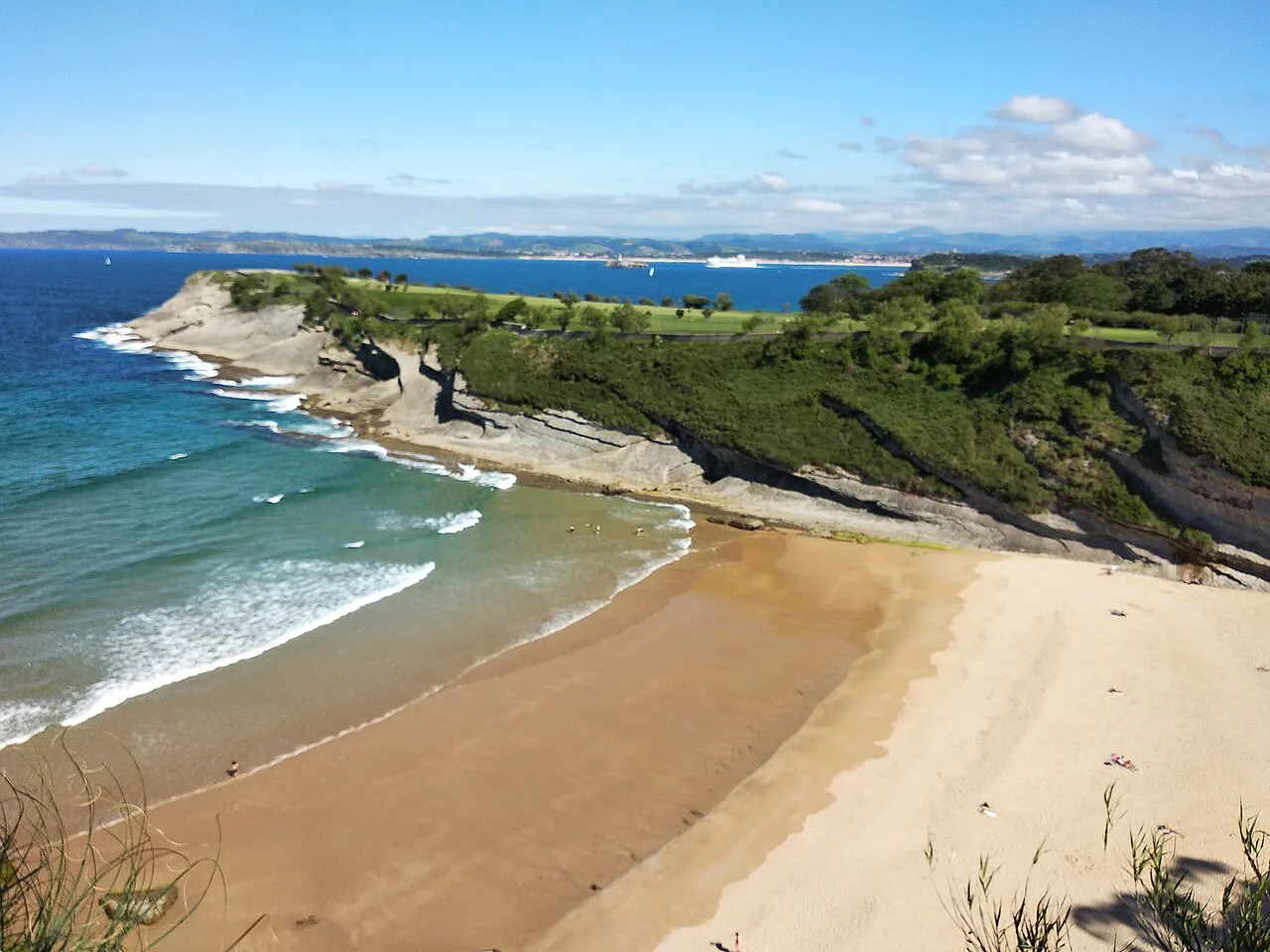
Mataleñas occupies a cove on Santander's northern shoreline, below the green slope of Parque de Mataleñas and within walking distance of the city's better-known bathing beaches. The park above covers a large grassy area that ends at the cliff edge, so the sand feels removed from the streets even though you are still inside the city boundary. Views run out to Isla de Mouro and its lighthouse, the landmark that frames most photographs of this stretch of coast.
Because the cove faces the open Bay of Biscay rather than the sheltered harbour, it behaves like a small Atlantic beach: compact, tide-dependent and exposed when the swell picks up. The nearest comparative beaches are Molinucos, a tiny cove just along the cliffs, and the two Sardinero beaches on the city side. Treat Mataleñas as one stop on a cliff-and-park walk rather than a standalone resort day.
Getting there
There is no road down to the sand. Walkers usually approach from the El Sardinero end of the city and follow the coast path and park paths to the cliff top, then take the steps down to the cove. Drivers follow signs for Forestal Park, the zipline centre in the park, and park when the road ends near the ice-cream van that marks the usual drop-off point, then continue on foot.
The descent is steep and the climb back up is the real constraint on the visit; anyone with knee trouble, a pushchair or a heavy cool bag should plan for it. Wear shoes with grip rather than flip-flops for the steps and carry everything you need down with you, because once you are on the sand there is no popping back to the car. Leave the beach with enough daylight and energy for the return climb, and keep the park at the top as an alternative picnic spot if the steps look unappealing.
The sand and the water
The cove is small, which is precisely its appeal: on a quiet morning you can have most of the sand to yourself. The trade-off is that it fills quickly once word spreads, so the difference between a serene swim and a cramped towel spot is often an hour or two of arrival time. The beach shelves more steeply than the long, gentle strands at Sardinero, so the water deepens sooner and small children need supervising close to the shoreline.
The open-sea setting means the sea state changes with the swell and the wind rather than staying glassy all day. Take the sea as you find it, watch the water for a while before committing, and keep to the edges of the cove if the swell is running. Swimming here rewards confident swimmers more than paddlers, and snorkelling is best around the rocky margins where the sand gives way to stone.
Shelter, wind and sea conditions
Cliffs rise on both sides of the cove, which takes the edge off the breeze at sand level while leaving the water itself open to the Bay of Biscay. On a windy day you will feel it most on the cliff top and on the exposed walk down, so bring a layer even in high summer. The cliffs also mean the beach loses the sun earlier than the open promenade at El Sardinero, which is worth knowing if you are planning a late-afternoon swim.
Facilities and the park above
Facilities belong to the park at the top rather than the beach itself. Parque de Mataleñas has a large green area with a children's playground and a 1,200-metre circuit, which makes it a natural base for a picnic, a run or a gentle stroll after the climb back up. Plan on carrying water, shade and food down with you; the park is where you regroup and refill rather than the sand.
The park circuit and playground are the reason Mataleñas works as a family half-day even when the cove is too rough for swimming. Children can use the playground and the grassy slopes while adults take turns on the steps for a swim. Pair the beach with the park rather than treating the sand as the whole outing.
How busy it gets and when to arrive
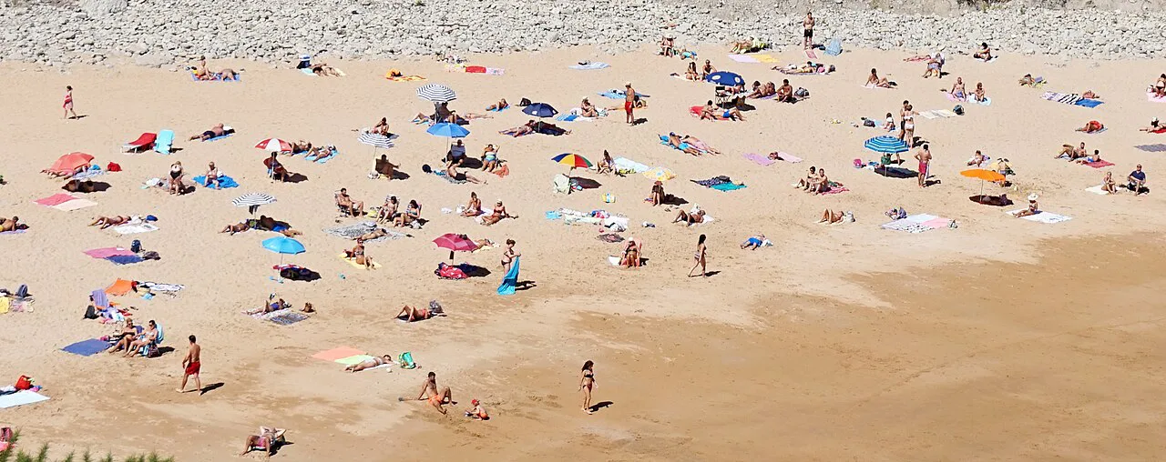
Mataleñas is a small cove with a narrow window of quiet. Come early in the morning, when the steps are still cool and the sand is mostly empty, or accept that you will be sharing a compact space by midday in high season. The walk down is part of the crowd control: the extra effort keeps numbers below those on the Sardinero promenade, so the beach rarely feels as packed as its size suggests.
The Sardinero beaches, by contrast, run for hundreds of metres with a full spread of services, so they absorb crowds that would overwhelm Mataleñas. If you want a long walk, a bar within a minute of your towel and space to spread out, book your day there instead and visit Mataleñas as a morning excursion. For the contrast in facilities and scale, read the Santander beaches guide before you commit. If you are weighing up a longer Spanish coastal break, the Sitges beaches offer a Mediterranean alternative to this Atlantic cove.
Best months for a swim
The Bay of Biscay warms slowly, and the sea off Santander is at its most comfortable from late July through September, when Atlantic water temperatures peak. Spain's official tourism site lists a water temperature of around 19°C for the Sardinero beaches, which gives a fair indication of what to expect on this stretch of coast in season. June and early July suit hardy swimmers and walkers more than paddlers, while October still offers pleasant beach weather with far fewer people.
Cantabria's weather shifts quickly, and a morning of cloud can turn into bright sun by lunchtime or the reverse. Local guidance puts the best months for the region between May and September, when conditions are typically mild and pleasant for the coast. Build flexibility into your plans rather than fixing on one beach day, and keep the park circuit as a fallback when the sea is up.
Nearby beaches to combine
The obvious pairing is a cliff walk that takes in Molinucos, the tiny cove with the best view of Mouro Island, before dropping to Mataleñas. From there, continue along the coast to the two Sardinero beaches and La Concha, which joins the first Sardinero at low tide. That sequence gives you a quiet swim, a viewpoint and a promenade with bars in a single half-day on foot.
Across the bay, El Puntal and Somo offer long Atlantic sands and a surf scene that is a world away from the intimacy of Mataleñas. The ferry from Santander to Somo makes a car-free day of it, and Somo beach has the surf schools, bars and space that the cove lacks. Farther west, the beaches around Comillas reward a separate day trip rather than a single itinerary.
Plan Your Visit
Mataleñas rewards the traveller who treats it as a walk with a swim at the end rather than a resort day. Arrive early, wear proper shoes for the steps, carry water and shade down, and leave time and energy for the climb back to the park. If you want promenade convenience, sunbeds and a bar within reach, the Sardinero beaches are the better base; if you want a small cove under the cliffs, the effort is the point.
Frequently Asked Questions
How do you get down to Playa de Mataleñas?
There is no road to the sand. Walkers come along the coast path from the El Sardinero end of Santander, reach the cliff top beside Parque de Mataleñas and take the steps down to the cove. Drivers head for the Forestal Park area, leave the car where the road ends and continue on foot for a steep descent and a steeper climb back.
Is Playa de Mataleñas good for families with young children?
It depends on your children. The cove shelves more steeply than the long Sardinero strands and the only way out is up the steps, so carry-heavy families have an easier day on the promenade beaches. Parque de Mataleñas at the top has a children's playground and a 1,200-metre circuit, which works well as a picnic base while adults take turns swimming.
How does Mataleñas compare with the Sardinero beaches?
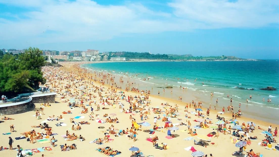
Sardinero is the city beach in the full sense: 350 metres of golden sand with sunshade and sun lounger rental, toilets, showers, a tourist office and a promenade lined with bars, and it is described as having a high occupancy rate. Mataleñas is the opposite trade — a small cliff-backed cove with a quiet morning and no promenade behind it, earned with a walk down and back up.
When is the sea warm enough to swim at Mataleñas?
The Bay of Biscay warms slowly, so late July to September is the comfortable window, with occasional good days into October. Water temperatures on this coast sit around 19°C in season, which is bracing rather than balmy, and sea conditions change with the swell, so judge the water on the day rather than by the month.
Which beaches are close to Playa de Mataleñas?
Molinucos is the nearest tiny cove, with the classic view of Mouro Island and its lighthouse. On the city side sit La Concha, which joins the first Sardinero at low tide, and the two Sardinero beaches. Across the bay, Somo and El Puntal offer long Atlantic sand and a ferry crossing from Santander.
Sources
Beach notes for your next trip
Optional updates when we add or revise beach guides.
You might also like
Continue reading
More guides you'll find useful