Tavolara Island Beaches: Day Trip Guide from Olbia
Plan a beach day on Tavolara Island from Olbia: boat access, the island's wild beaches, snorkelling and hiking, and Gallura beaches to combine.
On this page
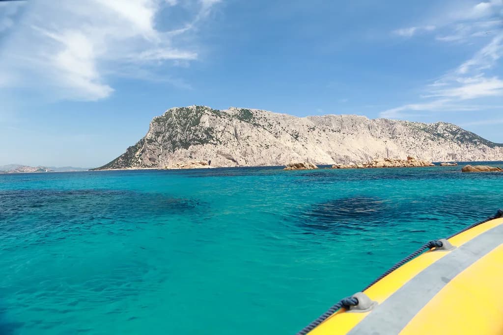
Tavolara Island is the rare Sardinian beach day where the journey is half the point: a limestone and granite mountain 560 metres high and 4 kilometres long, rising straight from the sea off north-eastern Sardinia. It suits travellers based in Olbia and the Gallura coast who want clear water, rock-and-shingle shorelines and a day shaped around a boat rather than a car park. Swimmers, snorkellers and fit walkers get the most from it; anyone expecting a broad sandy lido with rows of sunbeds should look elsewhere.
Why Tavolara Island is worth the crossing
The island is part of the Tavolara and Capo Cavallo Protected Marine Area, and Italia.it describes it as wild and unspoilt, with striking beaches, clear waters and seabeds suited to snorkelling and diving. That protected status is the reason to come: the appeal is scenery and water rather than resort infrastructure, and the day feels remote even though the mainland is within sight.
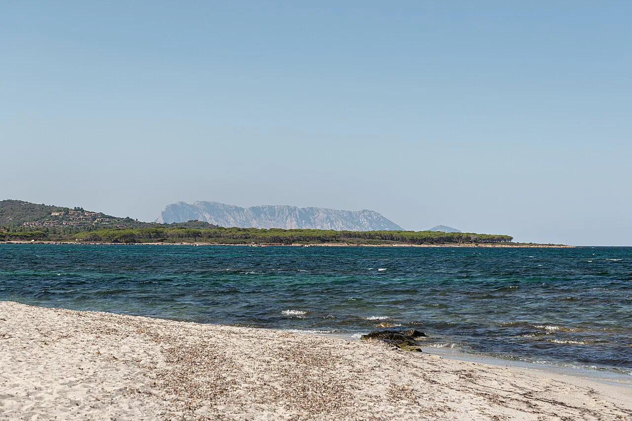
Tavolara is visible to the naked eye from the beaches of Gallura, so you can judge conditions from the mainland before committing to a crossing. It is also inhabited: Italia.it notes that the island is home to descendants of the Bertoleoni family, whose story as the world's smallest kingdom is part of local lore. Expect a living island with a small resident community rather than an abandoned rock.
Italia.it gives the island's dimensions as 560 metres high and 4 kilometres long, while Wikipedia describes a limestone massif about 5 kilometres long and 1 kilometre wide. Either way, the shape matters for planning: a long ridge with a narrow footprint means the shoreline is finite and the walking is vertical as soon as you leave the water.
Where Tavolara sits and how the island is laid out
The island lies off Sardinia's north-eastern coast in the Gulf of Olbia, close enough to the Gallura resorts that it dominates the horizon from the mainland beaches. Plan your day around the Spalmatore spit, the low tail of land at one end that gives the island's most accessible shore, and treat the granite flank beyond it as wilder ground for walkers and confident swimmers.
The 560-metre ridge runs the length of the island, and Italia.it lists hiking trails among its attractions, with the Via Ferrata degli Angeli aimed at more experienced walkers. Because the mountain rises directly behind the shore, a beach day and a hill day compete for the same hours; decide before you board which one you are doing.
Getting there: boats from Olbia and the Gallura coast
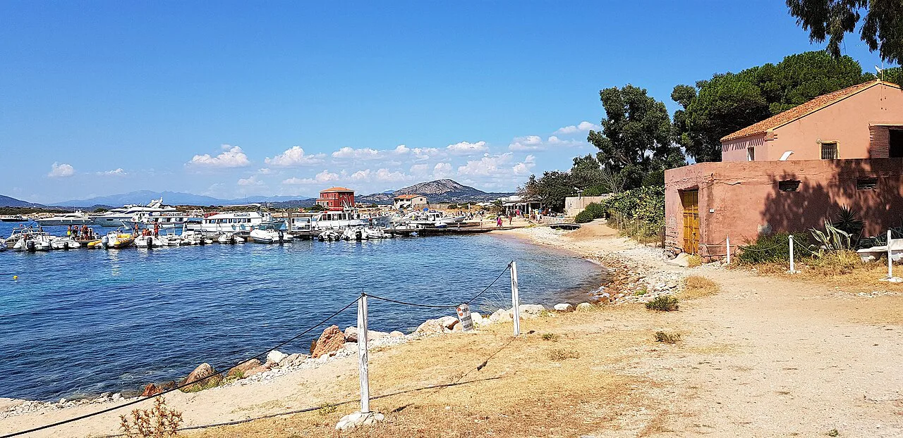
There is no bridge and no road onto Tavolara, so every visit starts with a boat. Crossings run from the mainland around the Gulf of Olbia, with the Porto San Paolo and San Teodoro shore the most practical departure side for travellers staying along this stretch of coast. Operators publish their own timetables and fares, so build the day around the first crossing you can realistically catch and leave enough slack for the return.
Because sailings are seasonal and can be reduced outside high summer, match your day to the published schedule of the ferry operators serving Tavolara rather than assuming an hourly shuttle. Book the return leg when you buy the outbound ticket if the operator offers it, and note the last boat back before you settle on the beach. The Tavolara Unlimited guide covers the practicalities of reaching the island alongside what to do once there.
If you are staying in Olbia itself, the crossing is a natural add-on to the town's wider beach options, many of which need a car or bus. Treat the boat trip as the fixed point in the day and fit the rest around it; the Olbia beaches guide covers the mainland alternatives for the days either side.
The beaches: shingle and rock, clear water and how the seabed drops
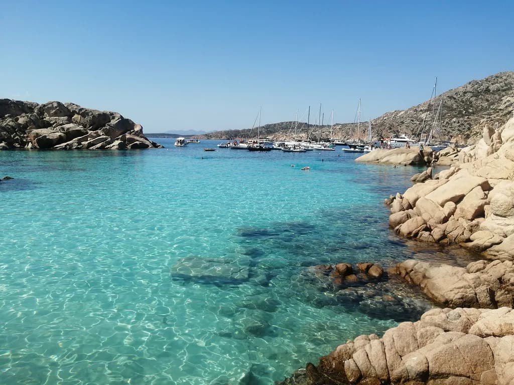
The shore here is shingle and rock rather than the fine sand of the Costa Smeralda postcards, so bring shoes you can wear into the water and a mat that copes with stones. The water clears quickly because the seabed shelves away from the shore, which makes for easy entry for adults but means small children need watching at the waterline.
Italia.it singles out the island's seabeds as spectacular and suited to snorkelling and diving, which reflects the rock and granite structure under the surface. Bring a mask if you have one; the appeal is what lies beneath the clear water rather than a long stretch of level sand.
Swimming and snorkelling in the protected marine area
The Tavolara and Capo Cavallo Protected Marine Area covers the waters around the island, and Italia.it presents the seabeds as a highlight for snorkellers and divers. The practical consequence is that the underwater scenery rewards a slow swim along the rocks rather than a straight out-and-back from the shore.
Go in with a buddy and stay within your depth on the rockier sections, keeping an eye on the water rather than the mountain. Because there is no broad sandy shelf to soften the exit, fins and reef shoes make getting in and out over stones considerably easier.
Wind, shelter and the island's granite edge
Shelter on Tavolara is a matter of choosing your side of the island. The Spalmatore spit gives the flattest, most accessible ground, while the granite edge along the mountain is exposed and suits walkers and strong swimmers rather than families settling in for the afternoon.
The crossing itself is the best wind gauge: if the Gulf of Olbia is choppy on the way out, expect the more exposed shore to be livelier still. Pick your spot on arrival rather than claiming the first patch of shingle you see, and keep bags weighted against the breeze.
Facilities and the Spalmatore spit
Tavolara is an island day out, not a lido crawl, so plan on carrying what you need: water, food, shade and something to sit on. The Spalmatore spit concentrates the island's easiest access and its handful of places to eat and drink, which is where most day-trippers end up.
Operators on the island publish what they offer, and it is worth knowing before you sail whether you are buying lunch ashore or bringing it. Fill bottles before boarding, since the island's supplies are finite and the walking is thirsty work.
Walks and the Via Ferrata degli Angeli
Italia.it lists a network of trails across the island and names the Via Ferrata degli Angeli as the route for more experienced hikers, running high above the sea. That route needs proper equipment and head for heights; it is not a beach stroll with a view.
If you want both water and height in one day, take the earliest crossing, walk first while it is cooler, and swim afterwards. Trying to fit a serious route and a relaxed beach afternoon into a single boat timetable usually means doing neither properly.
Wildlife and the island's isolation
The island's isolation and protected waters are what make it rewarding for wildlife-watchers, and Italia.it lists wildlife among Sardinia's attractions around this coast. Bring binoculars if you have them and scan the cliffs and water from a distance rather than approaching anything you spot.
The resident community is small and the infrastructure slight, which is precisely the appeal: a day here feels like stepping off the mainland's resort strip. Pack out what you bring in and treat the handful of homes and businesses as a working village rather than a theme park.
Best time to go: sea temperatures and peak months
The sea off north-eastern Sardinia is at its most comfortable from late June through September, with August the busiest month on boats and beaches alike. Late June and early September give warm water with noticeably thinner crowds and easier space on the crossing.
Boat schedules thin out either side of high summer, so check the published sailings of the Tavolara ferry operators before you build a shoulder-season day around the island. Outside the main season, a flexible plan with a mainland beach as backup is the sensible approach.
How long to allow ashore
A half-day ashore covers a swim, a wander along the Spalmatore spit and lunch; a full day adds a proper walk on the island's trails. Because everything is tied to the boat, the useful unit is the gap between sailings rather than hours on the beach.
First-time visitors should aim for the middle of the day, when the water is at its warmest and the light on the limestone is at its best, and plan to be back at the landing point ahead of the last crossing. Linger too long and you will be sprinting for the boat over shingle.
Nearby beaches to combine on the same day
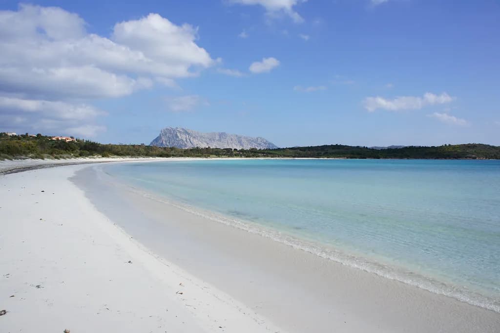
The Gulf of Olbia's mainland shore gives plenty of alternatives, and staying near Porto San Paolo or San Teodoro puts you close to both the ferry and some of the region's best-known sand. Cala Brandinchi is the obvious pairing for a second day: shallow, pale and entirely different in character from Tavolara's rock. If you would rather trade rock and shingle for a sandy town beach, the best beaches in Alghero offer a comparable day built around sand rather than a boat timetable.
If you have a car, the drive south to Cala Brandinchi and the San Teodoro coast takes you to wide sandy beaches that suit small children far better than the island's shingle. Compare the two and you get the full range of this coast: wild rock one day, calm shallow sand the next.
La Cinta beach at San Teodoro is another mainland option with a long, shallow sweep of sand that balances a day of rock and shingle. Base yourself on this stretch and you can mix a boat day on Tavolara with easier beach days without long drives.
Plan Your Visit
Tavolara rewards travellers who plan around the boat rather than the beach: check current crossing times before you travel, take the earliest sailing you can manage, and carry water, shade and shoes for the shingle. Do that, and the island's granite walls, clear water and protected seabeds deliver a day that feels far removed from the Gallura resort strip.
For the days either side, the Olbia beaches guide covers the mainland options, from the Spalmatore side of the gulf to the sandy stretches further south.
Frequently Asked Questions
Is Tavolara Island worth visiting?
Yes, if you want clear water, rock and shingle shorelines and a genuine sense of isolation within sight of the mainland. Italia.it describes the island as wild and unspoilt, with striking beaches and seabeds suited to snorkelling and diving. It is less suitable for families wanting broad sandy beaches with full resort facilities.
Do people live on Tavolara Island?
Yes. Italia.it notes that the island is inhabited by descendants of the Bertoleoni family, whose story as the world's smallest kingdom is part of local lore. The resident community is small, so treat the island as a working village rather than a resort.
How do I get to Tavolara Island?
By boat from the mainland around the Gulf of Olbia, with the Porto San Paolo and San Teodoro shore the most practical departure side for travellers staying along this coast. Operators publish their own timetables and fares, so check the schedule before planning your day.
How long is the ferry to Tavolara Island?
Crossing times vary by departure point and operator, and the published schedules should be checked before you travel. Build your day around the gap between sailings rather than a fixed number of hours on the beach.
What should I bring to Tavolara Island?
Water, food, shade, something to sit on and shoes you can wear into the water. The shore is shingle and rock rather than sand, and the island's supplies are limited, so it pays to arrive self-sufficient.
Sources
Beach notes for your next trip
Optional updates when we add or revise beach guides.
You might also like
Continue reading
More guides you'll find useful